No products
Prices are tax included
Stelvision 365 Sky Map – Folded Edition
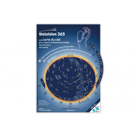
Carte du ciel Stelvision 365
New product
Stelvision 365 Sky Map – Folded Edition
Compact and detailed sky guide with rotating disk and removable planetary chart for year-round observation.
19 Items
Available.
More info
Stelvision 365 Sky Map – Folded Edition
DESCRIPTION
The Stelvision 365 sky map is a widely acclaimed tool for discovering the night sky. This double-A4 folded cardboard edition includes a rotating disk on the cover, enabling constellation tracking at any time of year between 40° and 55° north latitude. Inside, a removable two-sided chart offers planetary positions up to 2028. It also features a dedicated section on the main visible planets (Saturn, Jupiter, Mars, Venus), and two pages guiding you to deep-sky objects viewable with binoculars or a small telescope. It comes with a protective plastic sleeve for field use.
TECHNICAL SPECIFICATIONS
-
Edition: 15th
-
Format: double-A4 folded cardboard
-
Coverage: France, Switzerland, Belgium, Canada (40° to 55° north)
-
Rotating disk: shows visible constellations by date and time
-
Planets: 4-year removable position chart (valid through 2028)
-
Deep-sky objects: nebulae, clusters, and galaxies
-
Material: weather-resistant, protective plastic sleeve included
-
Audience: beginners and amateur stargazers


